Imagine a perfect day for cycling, where the open road calls, but the question lingers: where to ride? Whether you’re venturing beyond your familiar streets, seeking new bike paths, or exploring a city on two wheels, planning the ideal route is key to a rewarding experience.
For many cyclists, finding these routes often involves poring over maps and making educated guesses. While this can be part of the adventure, there’s a more efficient and insightful way to discover and plan your bike routes. This guide will walk you through using Google Maps as a powerful Route Bike Planner, ensuring you find safe, enjoyable paths, no matter where you are or what kind of cycling infrastructure is available.
Before we dive into Google Maps, it’s worth noting that tools like Strava and Ride with GPS heatmaps offer another fantastic way to plan routes by showing where cyclists frequently ride. These heatmaps highlight popular and likely safe routes based on aggregated cycling activity. However, for now, let’s focus on leveraging the capabilities of Google Maps to become your go-to route bike planner.
Unlocking the Bicycling Layer in Google Maps
Google Maps is more than just a navigation tool; it’s a comprehensive resource for cyclists. It meticulously tracks bike trails, dedicated bike lanes, bike-friendly streets, and even unpaved roads suitable for cycling. To access this wealth of information and transform Google Maps into your personal route bike planner, you need to activate the Bicycling layer. This layer isn’t visible by default, even when requesting biking directions, so enabling it is the first crucial step.
- On your phone: Look for the layers icon, typically located in the top left corner of the screen. Tap this icon and then select the “Biking” details layer.
- On your computer: Hover your cursor over the “Layers” icon, found in the bottom left corner. A menu will appear, and you can then click on the “Biking” details layer.
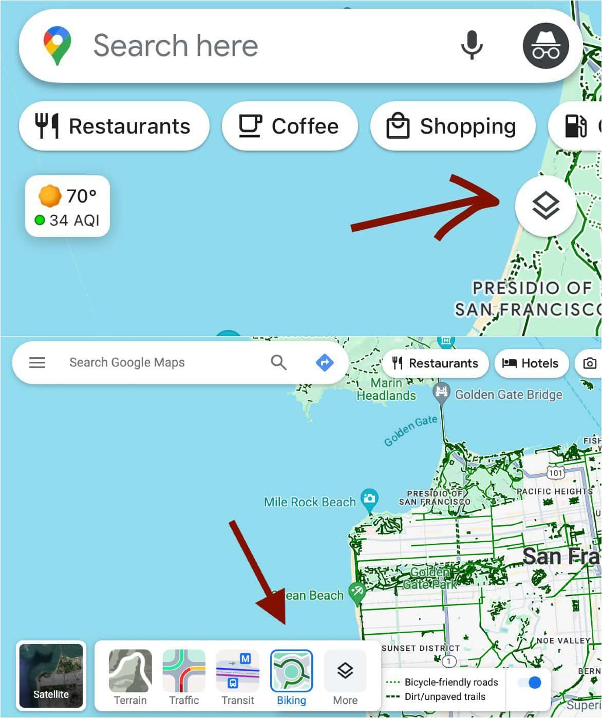 How to access layers on mobile (top) and desktop after a hover (bottom).
Once activated, the Bicycling layer overlays your map with cycling-specific information. Green lines indicate bike trails and dedicated lanes, while dotted lines represent bike-friendly streets. This visual representation instantly makes Google Maps a powerful route bike planner, revealing cycling infrastructure at your fingertips.
Enhancing Your Route Planning with Street View and Satellite View
Seeing bike-friendly routes on a map is a great start, but understanding the actual riding conditions is crucial for effective route planning. This is where Google Maps’ Street View and Satellite View become invaluable tools in your route bike planner toolkit. Street View allows you to virtually explore the street-level perspective of your potential route, while Satellite View provides an overhead look, useful for spotting trails and features not immediately apparent on the standard map.
Activating these views is straightforward:
- Mobile Street View: Long-press anywhere on the map. A red pin will drop, and if Street View is available, a thumbnail image will appear in the lower left corner, marked with a circular arrow icon. Tap this thumbnail to enter Street View.
- Desktop Street View: Click on a location on the map. The address will appear at the bottom of the screen, along with a thumbnail for Street View, if available. Click the thumbnail to enter Street View.
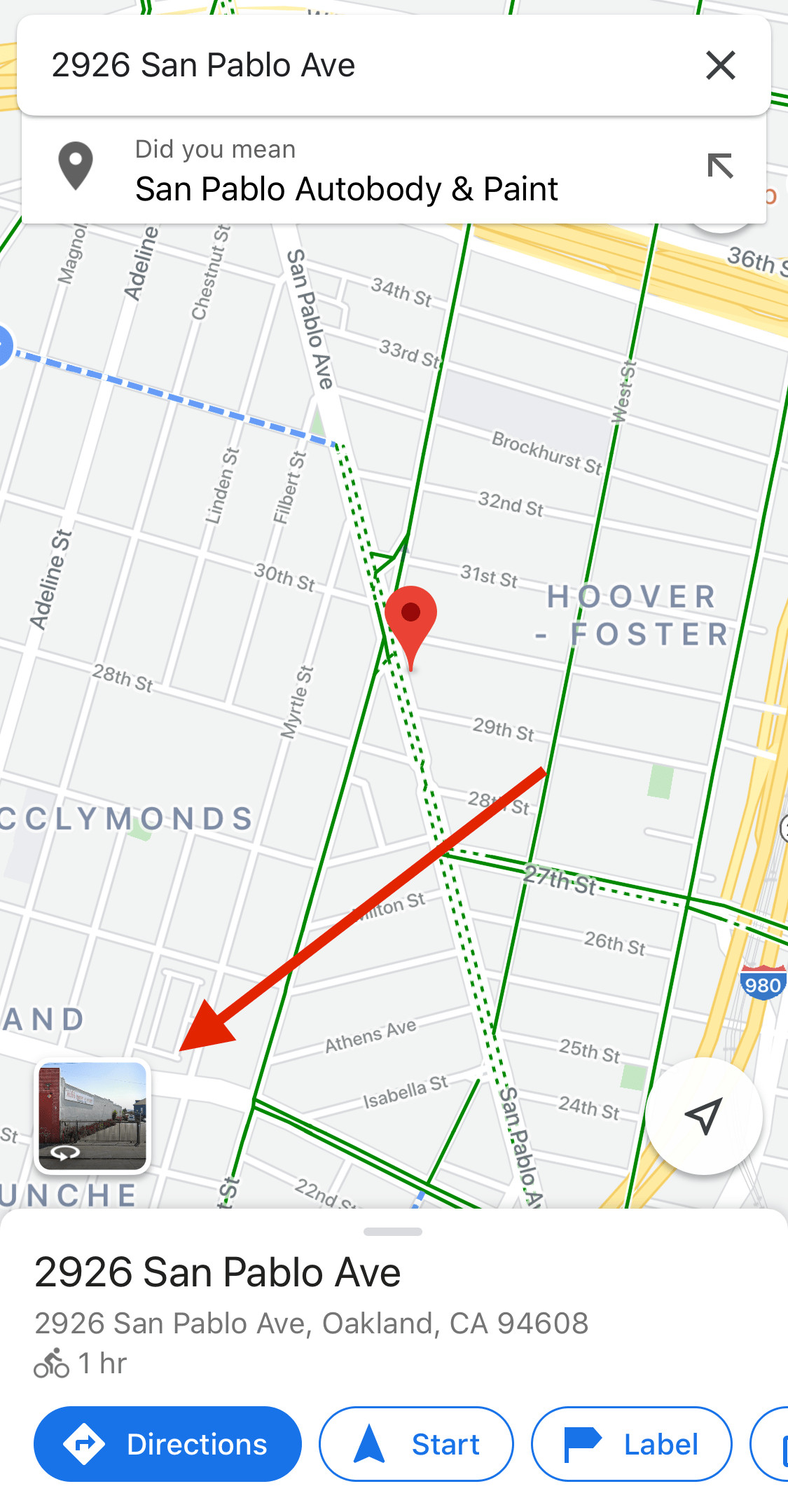 How to find the street view button on google maps mobile
 How to find the street view button on google maps desktop
Satellite View offers a broader perspective, allowing you to quickly scan areas for bike lanes, trails, and green spaces. It’s especially helpful for identifying paths that might not be clearly marked on the default map layer. By combining Street View and Satellite View, you can virtually pre-ride your route, assessing safety, scenery, and potential challenges before you even pedal out, making Google Maps an even more robust route bike planner.
Identifying Scenic Routes: Green Lines, Parks, and Green Spaces
For leisure cyclists, the joy of a bike ride often comes from immersing oneself in nature or enjoying picturesque surroundings. When using Google Maps as your route bike planner for recreational rides, focus on leveraging green lines, parks, and green spaces.
Long, solid green lines on the Bicycling layer typically indicate dedicated bike trails or bike lanes, often offering traffic-free or traffic-separated cycling. Parks and green spaces frequently feature shared-use paths perfect for leisurely rides. Linear parks, in particular, are excellent options. These elongated parks often follow rivers, lakeshores, or former railway lines, providing flat, scenic routes away from busy roads.
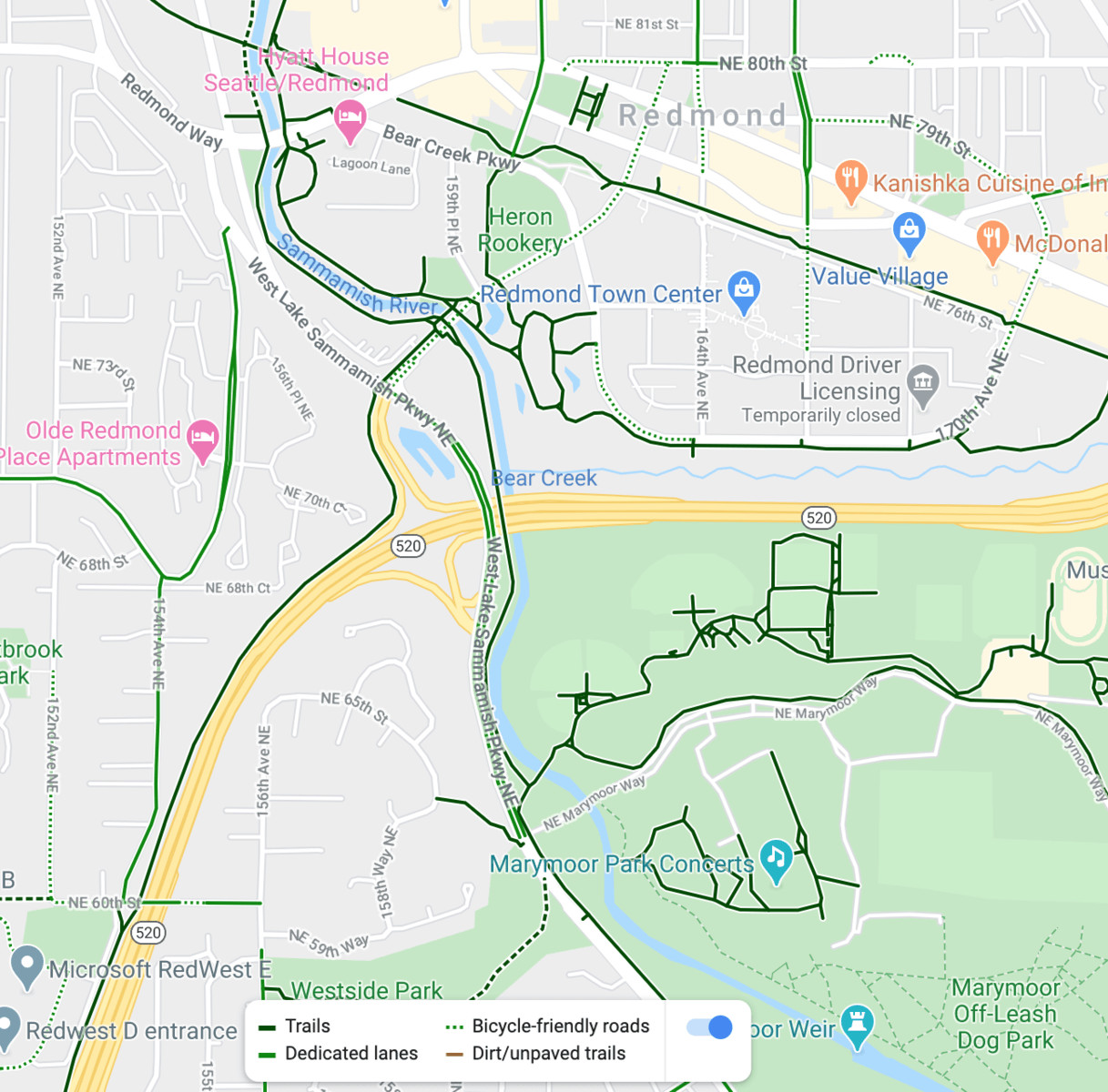 Lots of bike paths along rivers, roads, highways, and parks on this google maps screenshot
When planning your route, look for these green features and use Street View to get a sense of the scenery along these paths. Consider incorporating parks or landmarks as destinations for rest stops or picnics, enhancing your overall cycling experience. By prioritizing green routes, you transform Google Maps into a scenic route bike planner, guiding you to visually appealing and enjoyable rides.
Understanding “Bike-Friendly Streets” in Google Maps
Beyond dedicated bike infrastructure, Google Maps identifies “bike-friendly streets” with dotted green lines. These notations are crucial for urban route planning, but it’s important to understand what they represent to effectively use Google Maps as a safe route bike planner.
“Bike-friendly streets” generally fall into two categories:
- Quiet Residential Streets: These are typically located in residential areas, offering low traffic volumes and calmer cycling conditions, even without dedicated bike lanes.
- Designated Bike Routes on Busy Streets: Sometimes, a “bike-friendly street” designation applies to busier roads that are officially recognized bike routes by local authorities, even if they lack dedicated bike lanes. These may be the most practical option for cyclists navigating a city, though they require more vigilance.
While many “bike-friendly streets” are indeed pleasant to cycle on, it’s essential to exercise caution. Some may be busier than expected or lack sufficient space for comfortable cycling alongside traffic. Before committing to a route heavily reliant on “bike-friendly streets,” utilize Street View to assess the actual road conditions. Look for wide shoulders or any factors that might impact your safety and comfort. Being discerning about “bike-friendly streets” ensures Google Maps remains a reliable route bike planner, prioritizing your safety.
Uncovering Hidden Bike Routes: The Secret Bike-Friendly Streets
Google Maps, while comprehensive, isn’t always exhaustive. Many streets that are perfectly suitable and enjoyable for cycling aren’t officially marked as “bike-friendly.” This presents an opportunity to discover “secret” bike routes, enhancing your route bike planner capabilities beyond the obvious.
Often, these unmarked bike-friendly streets are local roads nestled between major arterial roads. They offer quieter alternatives to busier streets, providing a more peaceful and safer cycling environment. To find these hidden gems, explore residential neighborhoods on Google Maps, even if they aren’t highlighted with dotted green lines.
Street View is particularly useful for uncovering these secret routes. Virtually explore streets in residential areas and assess their suitability for cycling. Look for low traffic, wide roads, and pleasant surroundings. These unmarked streets can significantly expand your route options, allowing you to create more enjoyable and less stressful bike routes. By venturing beyond the marked routes, you can use Google Maps to become a more resourceful route bike planner, uncovering local cycling secrets.
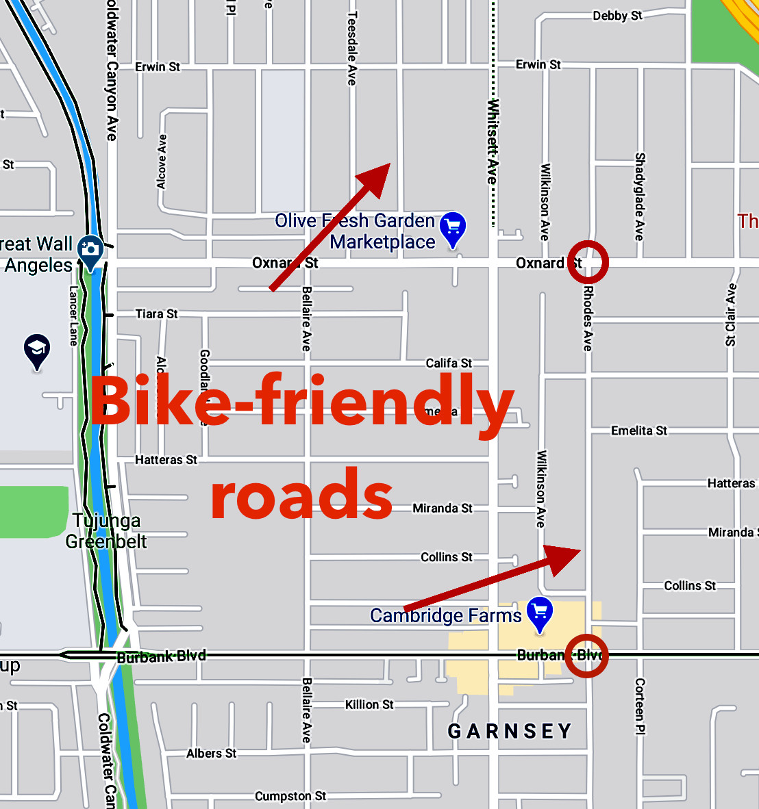 Bike friendly roads on google maps that aren
Gauging the Hills: Elevation Data for Route Planning
Elevation is a crucial factor for cyclists, especially when planning longer or more challenging rides. While Google Maps offers a Terrain layer, a more precise way to assess hills for your route is by utilizing the elevation graph within the route planning feature. This feature transforms Google Maps into an elevation-aware route bike planner.
To see the elevation profile of your route:
- Input your start and end points into Google Maps and select “Bicycle” as your mode of transport.
- Review the route options. Below the route suggestions, you’ll find an elevation graph depicting the elevation changes along each route.
- Customize your route by adding stops or dragging the route line on the desktop version. The elevation graph will dynamically update, allowing you to see how changes affect the hills.
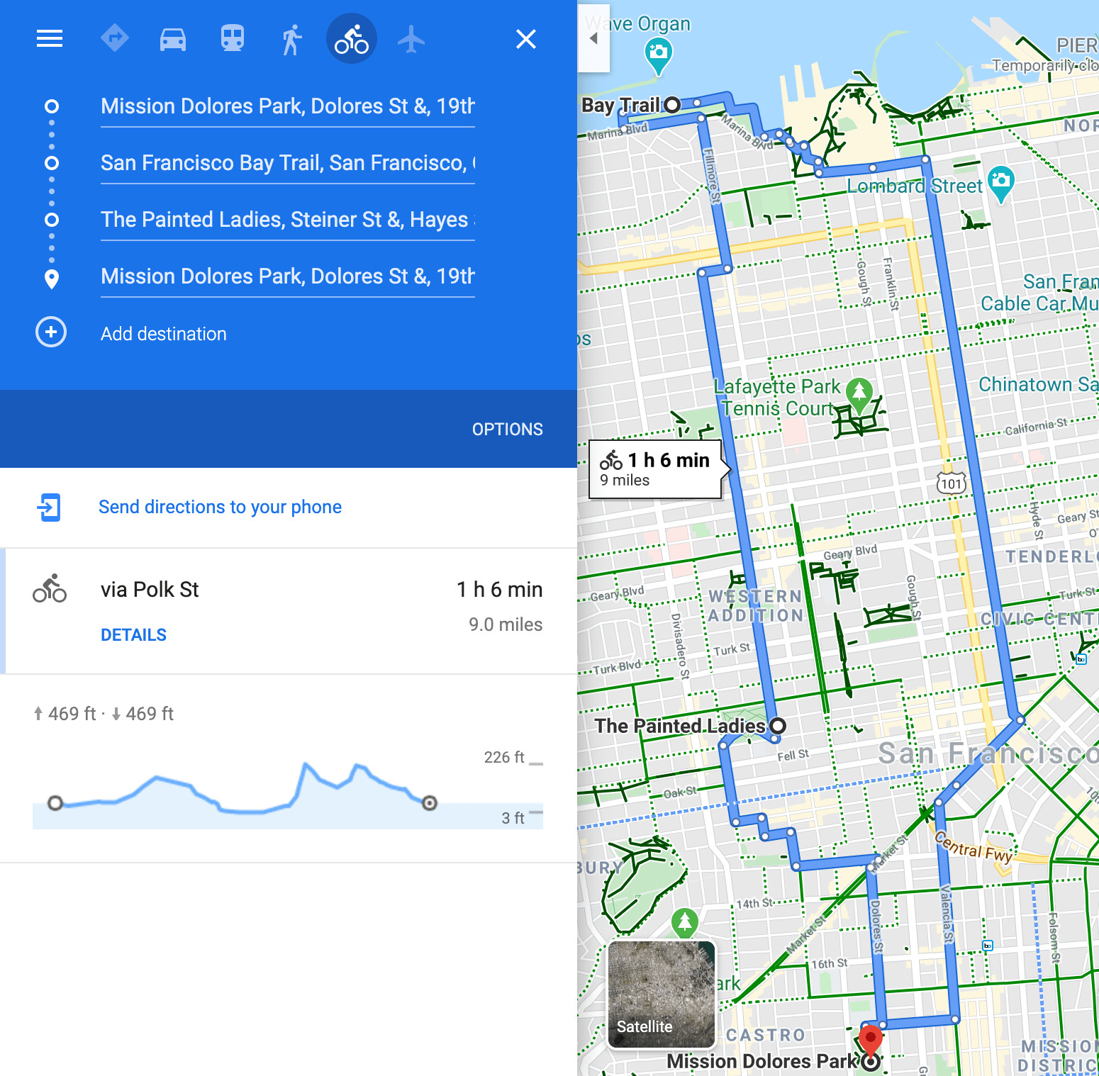 A loop of a nice hilly bike ride around San Francisco, going to the Marina, the Painted Ladies, and Dolores park.
Pay attention to the “Mostly flat” designation, but always click the dropdown arrow to view the actual elevation profile. Even seemingly flat routes can have noticeable inclines that can impact your ride, particularly on certain types of bikes. By carefully examining the elevation data, you can use Google Maps as a hill-conscious route bike planner, ensuring you’re prepared for the terrain ahead.
 Showing the slight, but existing hill on Valencia Street in San Francisco on Google Maps.
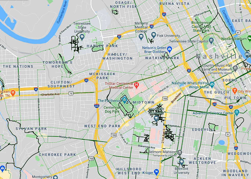
Route Planning Example: Exploring Nashville by Bike
Let’s put these route bike planner techniques into practice with an example. Imagine exploring Nashville, Tennessee, a city perhaps unfamiliar to you. By opening Google Maps and activating the Bicycling layer, you can immediately see potential bike routes.
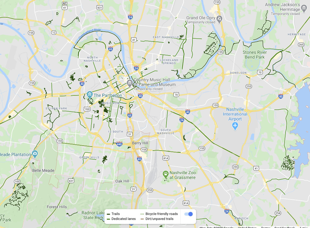 Nashville and all it
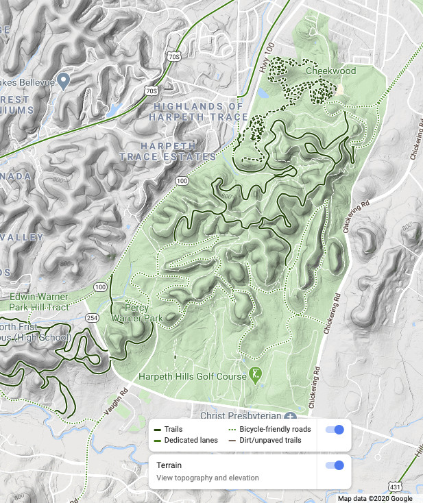
Notice the green lines along the rivers and in parks, suggesting scenic trails. To investigate further, zoom in on an area of interest, such as the lower left portion of the map, and activate the Terrain layer to understand the elevation changes.
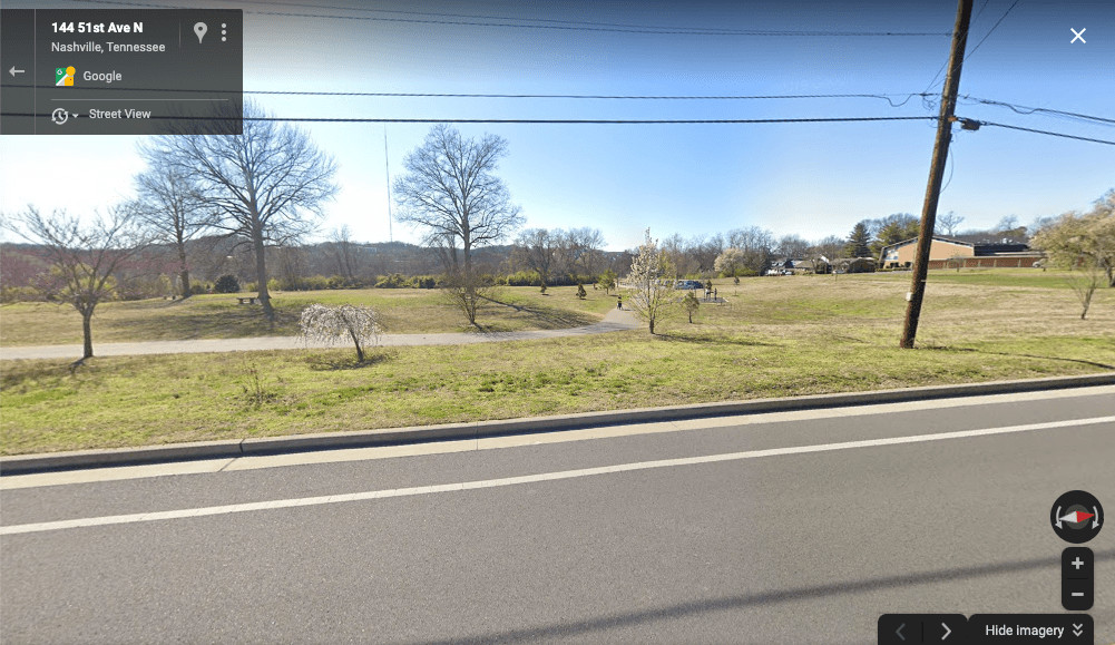
 A park with a shared use biking/walking path in Nashville.
To get precise elevation data for a specific route, use the directions feature and input starting and ending points along a potential path. The elevation profile will provide detailed information about the hills involved.
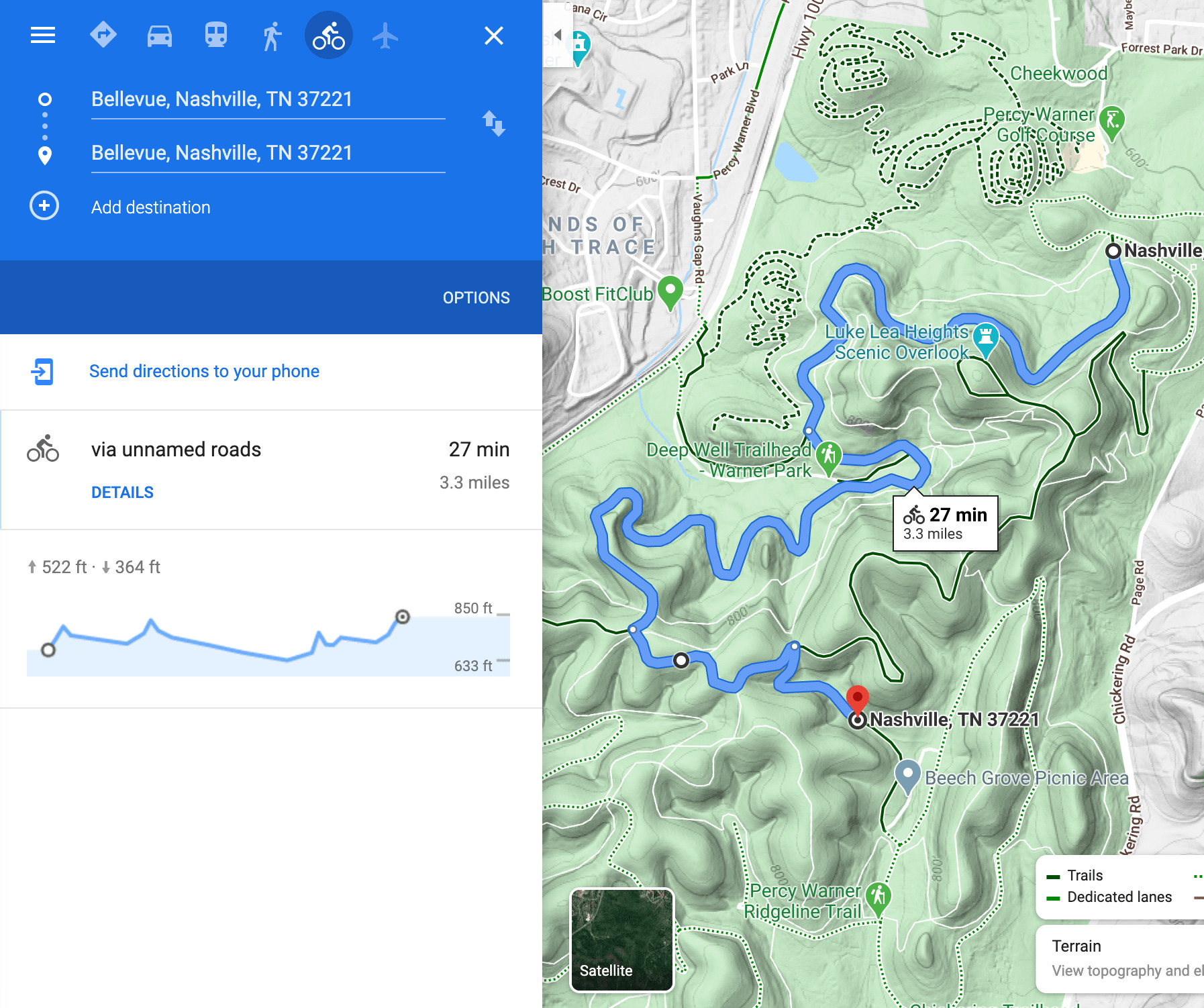 The hills of the bicycle park in Nashville.
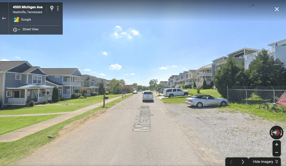
For urban exploration, zoom in on downtown Nashville to reveal “bike-friendly streets.” Use Street View to assess the conditions of these streets and nearby bike paths, like the loop in Sylvan Park.
 Close up of bike routes in Nashville, Tennessee.
By clicking on a “bike-friendly street” and utilizing Street View, you can confirm whether it aligns with your comfort level for cycling.
 Looking at Street view for a street in Nashville on Google Maps
 Street View of Nashville.
Finally, explore Street View along bike paths to get a sense of the actual riding environment.
 Street View of a bike path in Nashville.
Through this process of layering information, utilizing Street View and elevation data, you can effectively use Google Maps as your route bike planner to confidently explore new cities and discover great bike routes.
Beyond Google Maps: Additional Mapping Resources
While Google Maps is a versatile route bike planner, supplementing it with other resources can enhance your route discovery process.
Local Bike Maps
Local bike shops and cycling coalitions are invaluable sources for high-quality, locally-specific bike maps. These maps often provide detailed information about bike routes, trails, and local cycling infrastructure, sometimes exceeding the detail available on Google Maps. Physical maps or online versions from local sources can be excellent additions to your route planning toolkit.
Cycling Heatmaps and Dedicated Apps
As mentioned earlier, cycling heatmaps from platforms like Strava and Ride with GPS offer a unique perspective on route planning. These heatmaps aggregate data from millions of cyclists, visually highlighting popular and frequently ridden routes. This provides social proof of route quality and safety.
Ride with GPS stands out with its destination routing feature combined with heatmap visibility. This allows you to plan routes to specific destinations while simultaneously seeing popular cycling routes, a powerful combination for route discovery. Strava, while lacking direct destination routing, offers a route drawing tool for premium subscribers, enabling quick route creation based on heatmap data.
Other online mapping tools and cycling-specific apps can also provide valuable route information, often incorporating data sources beyond Google Maps.
Conclusion: Your Journey to Better Bike Routes
Planning bike routes doesn’t have to be guesswork. By mastering Google Maps as your route bike planner and utilizing supplementary resources, you can confidently discover safe, enjoyable, and scenic cycling routes wherever you are. Whether you’re exploring your neighborhood or a new city, the possibilities for bike adventures are limitless.
Start by exploring routes close to home – you might be surprised by the hidden gems you uncover. And remember to share your route discoveries and planning tips with fellow cyclists!
Before you head out, ensure you have essential bike gear and consider bringing a bike lock if you plan to stop and explore.
Happy biking, and may your route planning adventures lead to countless memorable rides!