The Great Divide Mountain Bike Route (GDMBR) stands as a monumental and globally acclaimed off-pavement cycling route. It stretches across the Continental Divide, traversing from Banff, Alberta, in Canada down to the US/Mexico border at Antelope Wells, New Mexico. This iconic route offers an unparalleled bikepacking experience through the heart of North America.
We respectfully acknowledge that a significant portion of this route meanders through the ancestral lands of numerous First Nations and Indigenous communities. For deeper understanding, resources are available at Native-Land.ca.
Conceived and meticulously mapped in 1997 by the Adventure Cycling Association, the Great Divide Mountain Bike Route spans approximately 2,700 miles (4,345 kilometers). It’s widely recognized as the spiritual birthplace of bikepacking, evolving from a rugged concept into a celebrated sport. Following the spine of the Continental Divide, approximately 90% of the GDMBR is unpaved, utilizing a network of well-maintained dirt and gravel roads, trails, and occasional stretches of more primitive tracks. While the GDMBR doesn’t demand extreme technical mountain biking skills, it presents a formidable endurance challenge. Cyclists must be prepared for over 200,000 feet (60,960 meters) of cumulative elevation gain and loss, testing their physical and mental fortitude over vast distances.
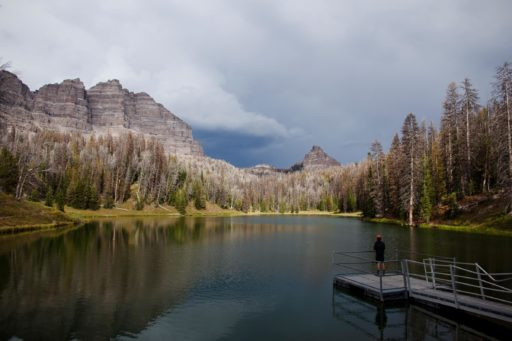
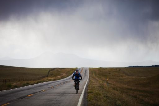
The GDMBR carves through a diverse panorama of the American West, showcasing breathtaking scenery, varied landscapes, and charming historic mountain towns nestled within immense wilderness areas. Route highlights include the lush Flathead Valley in Alberta, the majestic Grand Teton National Park, the stark beauty of the Great Divide Basin in Wyoming, the expansive South Park, the scenic Boreas Pass in Colorado, the intriguing Polvadera Mesa, and the remote Gila Wilderness in New Mexico. Indiana Pass in Colorado marks the route’s apex at 11,910 feet (3630 meters), offering stunning panoramic views. Throughout their journey, riders will encounter everything from verdant river valleys and remote mountain wilderness to open grasslands and arid high deserts, culminating in a remarkable passage through the expansive Chihuahuan Desert in the southern reaches of the route.
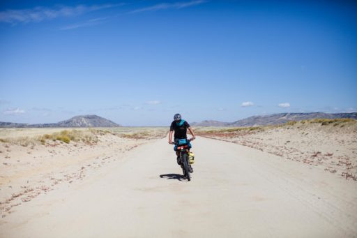
 Cyclists on the Great Divide Mountain Bike Route, navigating a gravel path with fully loaded bikes amidst a scenic mountain backdrop.
The route is most famously associated with the Tour Divide, an annual self-supported bikepacking race of extreme proportions. In this demanding event, time is continuous, and participants must rely solely on publicly available resources such as stores, motels, and bike shops for support. The current record for completing the Tour Divide is an astonishing 13 days, 22 hours, and 51 minutes, set by Mike Hall in 2016. Remarkably, the Tour Divide has seen successful completions on single-speed and tandem bicycles, highlighting the diverse approaches to tackling this epic route. With no entry fees or prizes, the race typically commences on the second weekend of June, drawing a dedicated community of endurance cyclists.
Route Difficulty Breakdown for the GDMBR
While the GDMBR is rated a 5.5 in difficulty, prospective riders should not underestimate its challenges. The route primarily consists of gravel and dirt roads, minimizing technical riding. Many Tour Divide racers opt for drop-bar bikes like the Salsa Cutthroat, known for its endurance capabilities on varied terrain. However, the sheer length of the GDMBR demands meticulous planning, particularly concerning appropriate gear for fluctuating weather conditions and strategic resupply points. Additional challenges include potential encounters with wildlife, notably grizzly bears in Montana, for which carrying bear spray is a common precaution. The significant elevation gain and riding at high altitudes also amplify the difficulty. Thorough preparation and research are crucial for a safe and successful GDMBR experience.
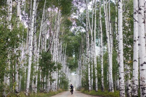
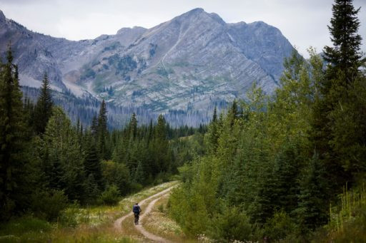
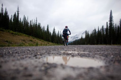
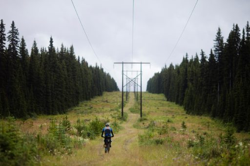
Exploring the GDMBR: Visual Journey
The Great Divide Mountain Bike Route offers a visually stunning experience, as captured in these images along the trail.
 A lone cyclist pauses on the Great Divide Mountain Bike Route, with their bike resting against a wooden fence, showcasing the vast, open landscape of the route.
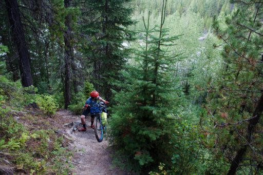
 A bikepacker navigates a rocky section of the Great Divide Mountain Bike Route, demonstrating the varied terrain and challenges of the trail.
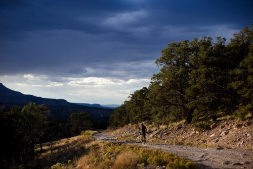
 A scenic view from the Great Divide Mountain Bike Route, overlooking a valley with a winding dirt road and distant mountains, illustrating the route's stunning vistas.
 Two cyclists on the Great Divide Mountain Bike Route cross a bridge over a clear mountain stream, highlighting the water crossings and natural beauty of the route.
 A cyclist camps beside their bike under a starlit sky on the Great Divide Mountain Bike Route, emphasizing the self-supported and wilderness aspect of bikepacking the route.
 A close-up of a cyclist's tires and gear as they ride on a gravel section of the Great Divide Mountain Bike Route, showcasing typical route surface and bikepacking setup.
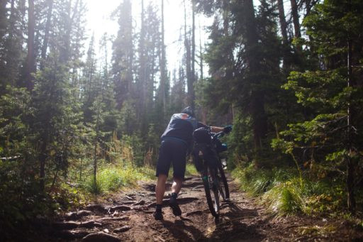
 A cyclist pushes their bike up a steep, rocky incline on the Great Divide Mountain Bike Route, demonstrating the demanding climbs and physical exertion required.
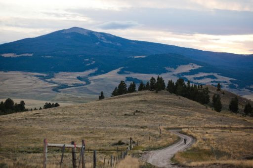
 A panoramic vista from the Great Divide Mountain Bike Route, featuring rolling hills, vast skies, and a distant dirt road, exemplifying the expansive and remote nature of the route.
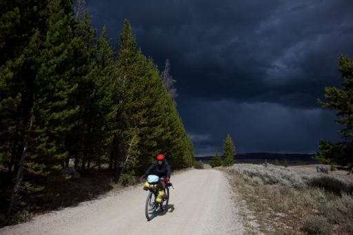
 A cyclist descends a winding dirt road on the Great Divide Mountain Bike Route, with a fully loaded bike and scenic mountain backdrop, illustrating the exhilarating descents of the route.
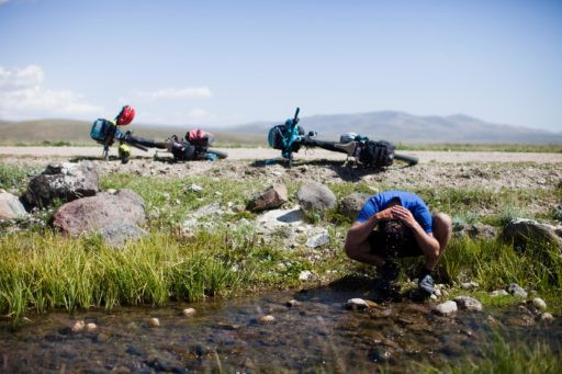
 A cyclist refills water from a clear stream along the Great Divide Mountain Bike Route, emphasizing the importance of water management and natural resources on the route.
 A cyclist rides through a field of wildflowers on the Great Divide Mountain Bike Route, showcasing the diverse and colorful landscapes encountered along the trail.
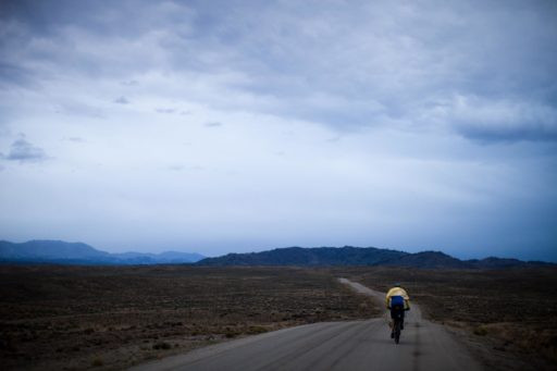
 A cyclist's silhouette against a sunset on the Great Divide Mountain Bike Route, with bike and gear visible, capturing the dramatic light and long riding days of the route.
 A cyclist navigates a muddy section of the Great Divide Mountain Bike Route, highlighting the variable trail conditions and need for adaptable riding skills.
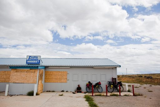
 Cyclists gather at a resupply point along the Great Divide Mountain Bike Route, with bikes parked outside a small town store, illustrating community interaction and resupply logistics.
 A cyclist repairs a flat tire on the Great Divide Mountain Bike Route, demonstrating the self-reliance and maintenance skills required for bikepacking adventures.
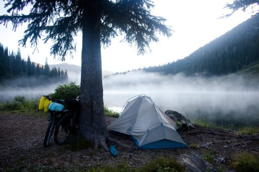
 A cyclist camps in a forest clearing on the Great Divide Mountain Bike Route, with tent set up and bike nearby, showcasing the solitude and natural camping opportunities.
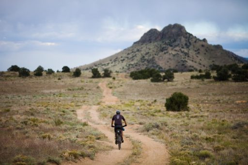
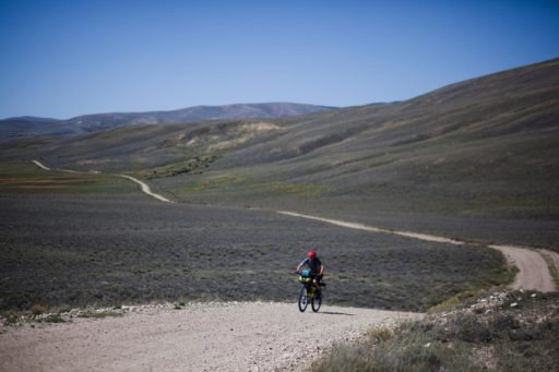 A cyclist rides through a high desert landscape on the Great Divide Mountain Bike Route, with arid vegetation and expansive skies, illustrating the dramatic landscape variations.
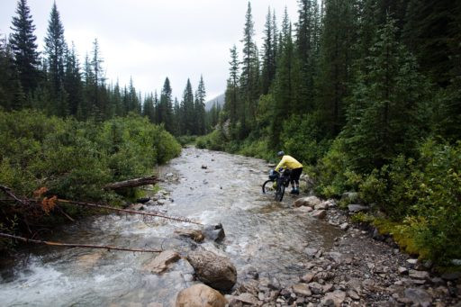
 A cyclist navigates a rocky river crossing on the Great Divide Mountain Bike Route, demonstrating the challenging water crossings and adventurous spirit of the route.
 A cyclist rides past a historic building in a small town along the Great Divide Mountain Bike Route, highlighting the cultural and historical points of interest along the trail.
 A cyclist enjoys a scenic descent on a dirt road along the Great Divide Mountain Bike Route, with panoramic mountain views and clear skies, capturing the freedom and exhilaration of the ride.
 A cyclist pushes their bike through deep mud on the Great Divide Mountain Bike Route, illustrating the challenging terrain and unpredictable conditions riders might face.
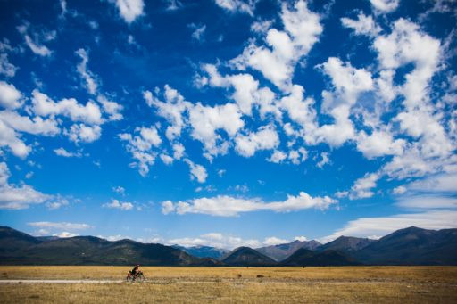
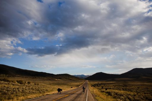
 A cyclist rides across a vast, open plain on the Great Divide Mountain Bike Route, with a dirt track stretching into the horizon, emphasizing the route's remoteness and scale.
 A cyclist checks a map along the Great Divide Mountain Bike Route, with bike parked beside them, highlighting the navigation and self-sufficiency required for the route.
 A cyclist stands at the US/Mexico border fence at Antelope Wells, the southern terminus of the Great Divide Mountain Bike Route, marking the completion of the epic journey.
Navigating the GDMBR: Maps, GPS, and Route Resources
It’s important to note that the GPX data provided here corresponds to the Tour Divide route, which has slight variations from the full GDMBR, particularly in New Mexico to bypass mud and obstacles. For the most current Tour Divide GPX tracks, TopoFusion is an excellent resource. For detailed mapping of the 2023 Tour Divide route including Points of Interest (POIs), consult the Trail Notes tab. However, for comprehensive GDMBR navigation, the Adventure Cycling Association’s GDMBR map set is highly recommended. These maps are user-friendly and essential, especially if you’re not solely reliant on GPS navigation. Before embarking, always check the Adventure Cycling Association’s updated Addenda for the latest route condition updates and reroutes. This proactive step can prevent unexpected detours, as route conditions can change due to weather or other factors. Also, the Temporary ACA Route Road Closures forum provides real-time information on route issues. Refer to the Trail Notes tab for further details on GPX and navigation tools.
Download GPX Submit Route Alert Help
Route Alert Submission
BIKEPACKING.com is committed to maintaining and enhancing the network of bikepacking routes. They rely on the bikepacking community to report critical issues and opportunities for route improvement, conservation, and community engagement. If you encounter any significant issues or opportunities related to the GDMBR, please submit a route alert concerning:
- Highlights
- Must Know Information
- Camping Locations
- Food and Water Resources
- Trail Notes and Conditions
- Resources and Points of Interest
Key Highlights of the Great Divide Mountain Bike Route
- Traverse the American West: Experience a diverse cross-section of landscapes.
- Varied Terrain: Encounter spectacular scenery, historic mountain towns, and remote wilderness.
- Flathead Valley (Alberta): Begin your journey in this stunning valley.
- Grand Teton National Park: Witness the grandeur of the Tetons.
- Great Divide Basin (Wyoming): Explore the unique high desert environment.
- South Park (Colorado): Ride through this expansive and scenic region.
- Boreas Pass (Colorado): Ascend this historic and picturesque pass.
- Polvadera Mesa: Discover the intriguing landscapes of this mesa.
- Gila Wilderness (New Mexico): Explore the rugged beauty of the Gila Wilderness.
- Indiana Pass (Colorado): Reach the highest point on the route at 11,910 feet.
- Wild River Valleys and Deserts: Transition through diverse ecosystems.
- Chihuahuan Desert: Conclude your journey through this iconic desert.
Weather Considerations and Best Time to Ride
Weather along the GDMBR is notoriously unpredictable, especially at higher elevations where conditions can change rapidly. Generally, the route is most accessible from late June through mid-October. However, be prepared for potential snow at higher elevations even during these months. Mid-August is often considered an ideal departure time, offering warmer conditions in Canada and Montana while avoiding early snow in Colorado and the intense heat of New Mexico. However, be aware of the monsoon season in New Mexico, which can bring significant rainfall.
Expect cold nights, with potential frost, even in August. Layering clothing is essential, and a sleeping bag rated to 20 degrees Fahrenheit (approximately -7 degrees Celsius) is advisable. For ultralight setups, consider a sleeping bag liner for added warmth at higher altitudes.
Riding in June or early July increases the likelihood of encountering snow in high mountain passes and potentially higher river and stream levels due to snowmelt.
Logistics: Getting to the Start and Returning from the Finish
Reaching Banff, Canada (Start): The most convenient airport is Calgary International Airport (YYC). Banff is about 80 miles (125 km) west of Calgary. Transportation options from the airport to Banff include rental cars, shuttle services, or cycling. Renting a car can be cost-effective for groups and offers flexibility.
Once in Banff, a well-known mountain resort town, bike assembly and final preparations can be done. Bike shops like Snowtips-Bactrax offer assistance and last-minute supplies. Allow ample time for errands and potential delays before starting your ride. Consider booking accommodation in advance, as Banff can be expensive, especially during peak season. Tunnel Mountain Campgrounds, just outside of town, is a slightly more affordable option.
Returning from Antelope Wells, New Mexico (Finish): Antelope Wells offers a stark contrast to Banff, marked by the US/Mexico border fence rather than celebratory crowds. To avoid a long ride to an airport, pre-arranged shuttle services are highly recommended. El Paso, TX (ELP) and Tucson, AZ (TUS) airports are both approximately a 3-4 hour drive from Antelope Wells. El Paso is a common choice. Bikes can be shipped relatively easily and affordably via Amtrak.
Camping and Accommodation Along the GDMBR
A significant portion of the GDMBR traverses BLM land, national parks, and designated wilderness areas, providing ample primitive camping opportunities. ACA maps and guidebooks offer detailed camping and lodging information to help plan your overnight stops based on your daily mileage and desired pace.
WarmShowers.org also lists hosts along the route, offering cyclist-friendly lodging. Check availability and download the app for access during your ride.
Cyclist-specific lodging options noted on maps can be invaluable and often provide unique experiences.
Tip: Especially near Lincoln and before Helena, Montana, book cyclist-only lodging in advance. Brush Mountain Lodge is highly recommended for its affordability, knowledgeable hosts, and welcoming atmosphere, complete with a jacuzzi.
Food and Water Resupply Strategies
Be prepared for long stretches on the GDMBR with limited resupply options. Some sections can have over 100 miles (160 km) between reliable food and water sources. The ACA map set is crucial for identifying resupply points. Always carry a water filter. While towns with at least gas stations are relatively frequent, always pack more food and water than you anticipate needing. Notable sections with limited resupply include the Flathead Valley, Great Basin, and Polvadera Mesa.
Larger towns along the GDMBR include Helena and Butte (Montana), Pinedale and Rawlins (Wyoming), Steamboat Springs, Breckenridge, Salida, and Del Norte (Colorado), and Grants and Silver City (New Mexico). Smaller towns offer limited supplies and services.
Tip: Stock up adequately in Pinedale before entering the Great Basin. Atlantic City may have limited or no services.
Tip: The Diagnus Well in the Great Basin can be easily missed. Pay close attention to mileage and look for a pile of rocks and a stick with a brightly colored tip.
Tip: Hopewell Lake campground offers excellent water and is a great spot to resupply and listen to coyotes at night.
Tip: The Toaster House in Pie Town is a must-visit for cyclists.
Route GPX and Variations
The GPX data provided is for the Tour Divide route, not the official ACA GDMBR route. It includes Tour Divide-specific alternates, such as bypassing Rawlins, WY, via Wamsutter for resupply. TopoFusion details these alternates:
- Fernie Alt (not suitable for BOB trailers).
- High Rockies Trail-North (west side of Spray River).
- Butte route with singletrack on “Big Butte”.
- Kanasakis Lakes Provincial Park Road (replaces bike path).
- Wyoming re-routes: Union Pass/Fish Lake and Great Basin/Wamsutter.
- ACA alternate into Butte.
- FR 212 detour near Kremmling, CO, and Gold Dust trail near Breckenridge.
Consult TopoFusion.com for annual Tour Divide GPX files.
Points of Interest (POI) Resources
ACA maps and detailed PDF lists like the MasterTD2019_v1.pdf provide POI information for the GDMBR and Tour Divide. Sarah Swallow’s detailed POI map of the 2023 Tour Divide route is another valuable resource, along with her route collection breaking down the 2023 Tour Divide into seven sections and a resupply cheat sheet detailing mile marker locations and distances between services.
Navigation Tips and Materials
Michael McCoy’s “Cycling the Great Divide” guidebook is a helpful resource for daily planning, offering elevation details and local history. While the guidebook and maps share cue sheets, mileage discrepancies can occur, so use both with caution. The book is structured into 70 riding days, but riders often cover two “days” per day. Both the guidebook and maps suggest route alternates.
Tip: Use maps and guidebooks as guides, but prepare for unexpected conditions. Towns may have limited services, water sources may be dry, and climbs can be more challenging than indicated.
Tip: New Mexico roads are often the most primitive and washboarded. Consider front suspension or a Thudbuster seatpost, especially in New Mexico. 29+ bikes can be ideal, although extra tire width might slow you down in some sections.
GDMBR Timing and Race Records
The Tour Divide race attracts a select group of endurance athletes. Here are Grand Depart winners since 2008:
(List of winners as in the original article)
Current Records:
Men: Mike Hall – 2016 – 13:22:51
Women: Lael Wilcox – 2015/ITT – 15:10:59
Route Details and Helpful Resources
(Links to helpful resources as in the original article)
Gear Planning for the GDMBR
Gear selection is crucial for GDMBR success. Prioritize weight and food carrying capacity. Many gear setups are viable for the Tour Divide. The original article authors used Surly Ogre bikes with robust components and tubeless Maxxis Ardent tires.
Mechanical issues were minimal for them, with rack failures being the primary issue, suggesting the benefits of soft bag systems. Pack lists vary based on riding style, speed goals, and skill level.
(List of clothing, equipment, bike components, and luggage as in the original article)
Terms of Use: Cycling the GDMBR is at your own risk. Check conditions, closures, and obey regulations. Carry safety and navigation gear and follow Leave No Trace principles. Route information is for inspiration and planning, not guaranteed for accuracy. BIKEPACKING.com LLC is not liable for injury or damage.
Filed In:
USA, bikepacking-colorado, bikepacking-ultra-racing, tour-divide.